A couple of months ago, I mopped up five parks from Christchurch to Milford-on-Sea in the Coast Road Rove. Today I followed much the same route, extending the start into Bournemouth and the end all the way, at last, to Hurst Castle.
It’s been a long time coming. GB-1725 Hurst Spit and Lymington River Estuary SSSI is the only park left on my to-do list with a number less than 5000; it might even have been in the system at the point I started doing POTA just under two years ago, and yet I’d never activated it.
It also marks an ending for part of this project: the sharing of my childhood photos, as I revisit all the places I remember from long ago. This is the big one. One particular photo of my dad and I has sat on my parents’ mantelpieces and cupboards for thirty-five years now, my only childhood photo to have held that spot continuously for so long. It was taken at Hurst Castle, in the exact spot I set up my station this afternoon.
But Hurst Castle was the reward at the end of a day of activations. Before I could get there, three small town parks awaited…
0900-0930Z: Woodland Walk
The first of two parallel parks on Southbourne seafront, both all-time new ones in the POTA system, was GB-6349 Woodland Walk. There’s not a lot of room here, especially in April with the carpet of flowers in bloom, and I struggled to find space even for the smaller footprint of the JPC-12 vertical. You can see from the photo just how close I was to the road!
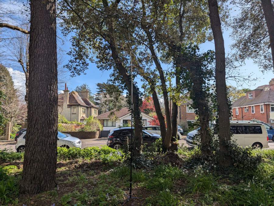
As with all today’s activations, I was using my Yaesu FT-891 and Eco-Worthy 20Ah battery.
Sat on a bench on the single path through Woodland Walk, I was getting a lot of attention from walkers and dogs alike, so once I had my 10 in the log, I packed up again. Almost all my contacts were in Spain and Portugal here, compared to the majority in Fishermans Walk which were in Poland or Finland, so I assume the layout of my ground radials in the confined space here was affecting propagation.
0950-1030Z: Fishermans Walk
After a coffee from the Bowls Club cafe, it was time for GB-6350 Fishermans Walk just up the road. Although it’s another long thin park between two roads, this one is about twice as wide as Woodland Walk, so there’s more green space and I could set up without being directly on the path.
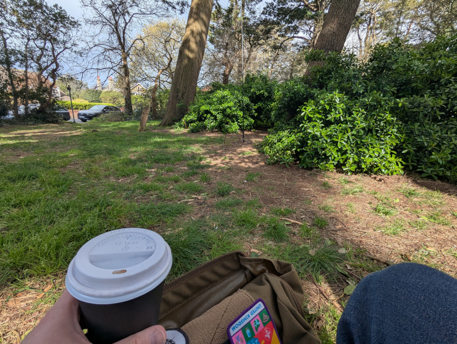
This was a slow one, taking 4-5 minutes between contacts to start with. As I mentioned, these were largely Poland and Finland. I did rearrange the ground radials to see if it would bring the rest of Europe into play, but sadly not. It did however score me my only two transatlantic contacts of the day—of course with W1OW and K2UPD.
1100-1145Z: Mudeford Quay
Further down the coast, another new addition to the POTA list is GB-6489 Mudeford Quay. There’s an area of grass here with picnic tables and benches that gets very busy in the summer, but luckily on an April Monday before the tourist season, there was plenty of space for me to break out the 40m inverted-V dipole.
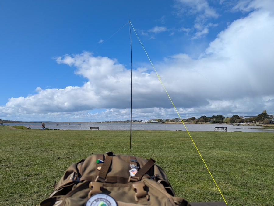
I had only just set up here when a fellow ham clocked my antenna and came over for a chat. But after that, the contacts on the radio came quickly, and I had 14 in the log within as many minutes.
Despite the forecast suggesting a chance of rain, the weather had turned out gorgeous. Bright sunshine and blue skies lit a scene of sandy beaches and gently rippling water; honestly, who could ask for better?
1300-1600Z: Hurst Castle
Time for the big one. A half-hour drive down the coast brought me back to near Sturt Pond, and took me past many of my Coast Rove activation spots. This isn’t a part of my local area that I visited that much before portable radio became my thing, and I love the fact that I now recognise more and more of it; places becoming knitted together in my mind. I have memories all over the place, now.
From the corner of Saltgrass Lane, it’s about a mile and a half’s walk along Hurst Spit, a gravel bank on which walking is occasionally tricky. For the less able, there’s a ferry from Keyhaven during the spring and summer (including today, but I wanted the walk).
I think this was probably my third visit. Besides the visit on which the photo was taken, we also had a school trip here once; combined between History and Geography. I’m sure the teachers must have loved it—where else can you cover the Tudors, the Victorians, and long-shore drift all in one place?
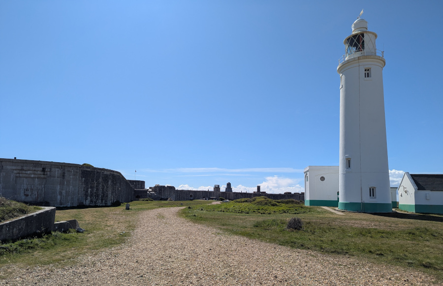
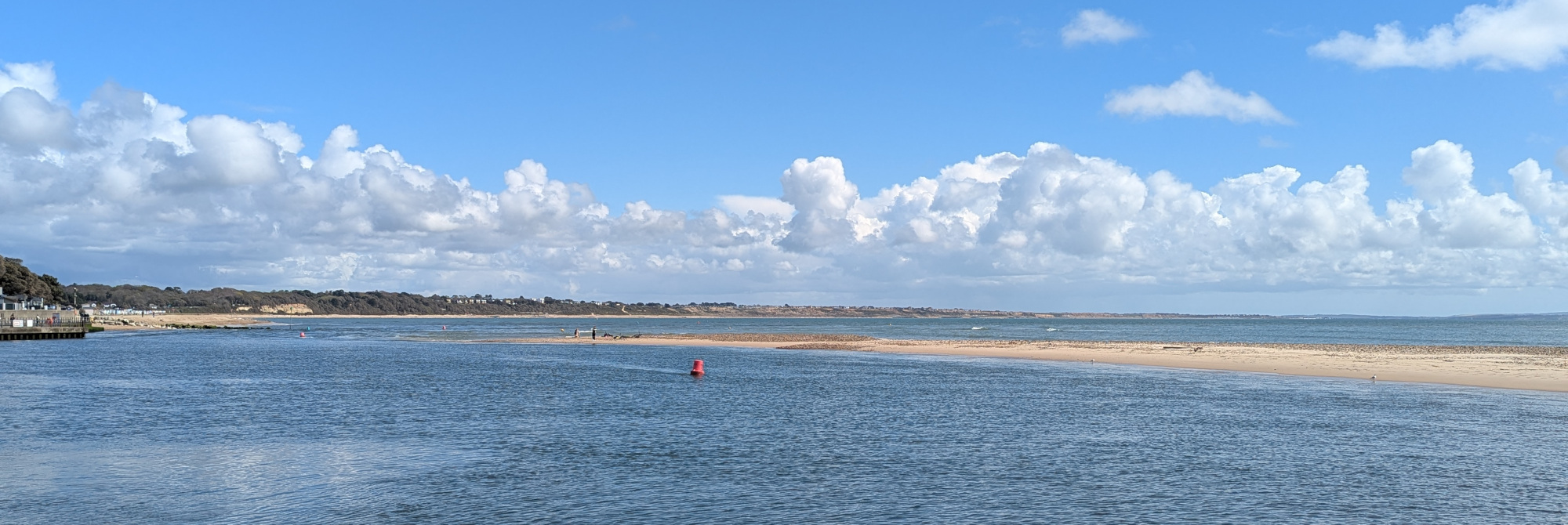
In the picture above you can see Hurst Castle (WCA G-00229) itself along the left. It’s been used to defend the Solent from invaders pretty much since the invention of cannon, with one of its later incarnations qualifying it for WWBOTA as bunker B/G-2733. The two domes in the distance are ARLHS lighthouses ENG 253 and ENG 058, while the more traditional-looking white lighthouse on the right is ENG-057.
But beyond the castle with its Tudor centre and Victorian wings, beyond the white lighthouse, right at the end of the spit, lies the spot where in August 1989, my mum took that photo that has been a constant presence in our lives ever since:
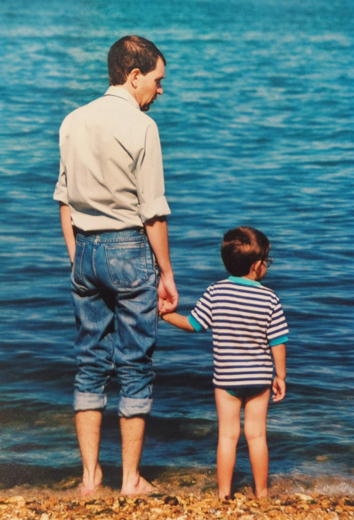
The land itself has changed since then; I had a long chat with a fisherman about how different the end of the spit used to be before various man-made changes affected the flow of the currents around it. But the spot from which that photo was taken was still there, identifiable enough from the other wider-angle shots taken on the same visit.
I decided against taking my trousers off and wading into the sea today—not the best look for someone now in their forties— but it proved a great spot for an antenna instead.
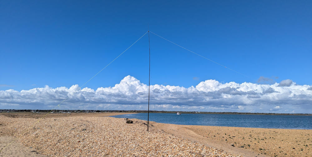
I started with the JPC-12 antenna on 20 metres, and made a respectable 17 contacts. That felt like enough, but I really fancied giving 40 metres a go.
I wasn’t confident that the dipole antenna would hold up, given the increasing wind and the lack of any real ground in which to peg out the guy ropes. Each peg slid only a couple of centimetres into sand before it hit stone, but I heaped a pile of stones around each peg and hoped it would hold for a few minutes while I tried the band.
But hold it did, for 67 minutes, and 96 QSOs.
Who would have thought a park-beach-bunker-castle-lighthouse activation would get so much interest?!
Almost from the start I had a huge pile-up, and it just kept going and going. By the time an hour had passed, I was stumbling over my conversations; my brain was clearly fried by that point.
By the end I was picking the last few stations out of the noise and giving 22 reports after many retries, but we made the contacts in the end. All in all, 113 QSOs made from Hurst Castle, more than qualifying it for a POTA, BOTA, WWBOTA, WCA and ARLHS activation.
In total on today’s rove, that was 38 QSOs on 20m and 110 on 40m, for a total of 148. Phew!
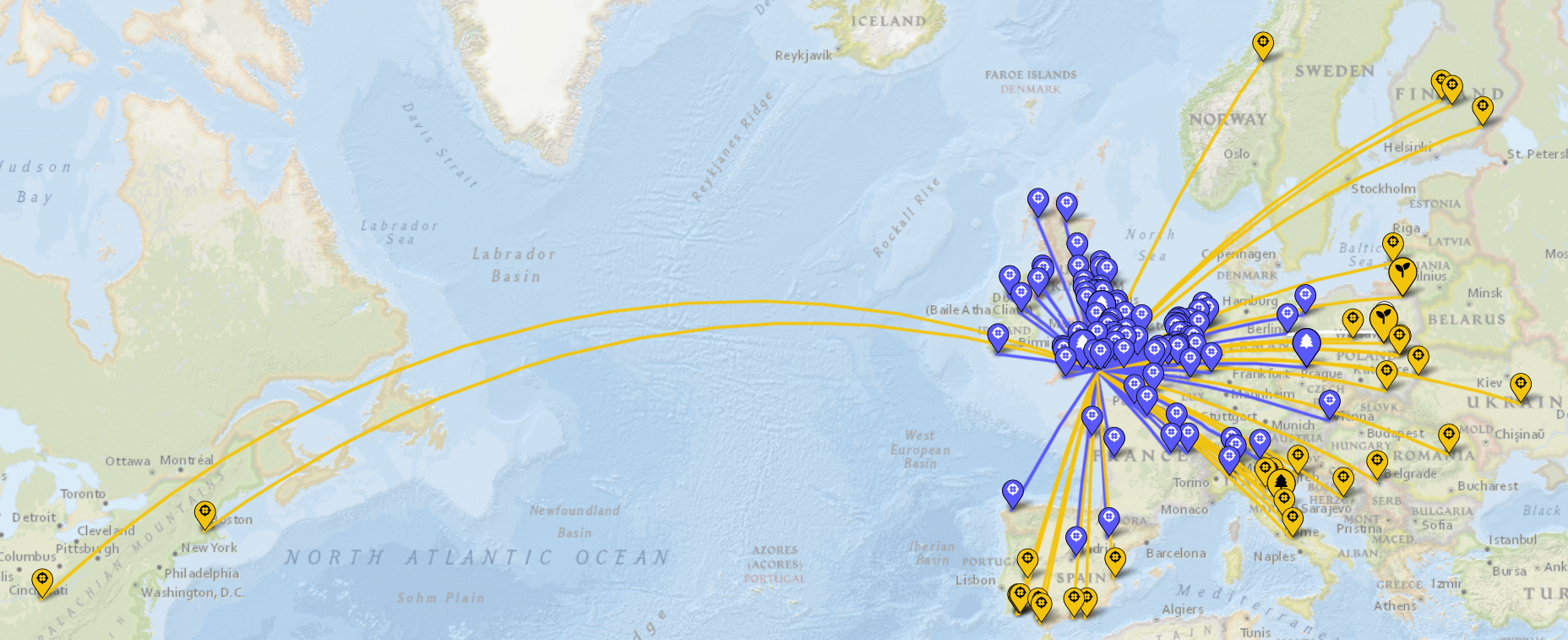
Thanks to my contacts during today’s activations, especially to the hunters who kept coming back throughout the day and to those of you that joined in the huge park-beach-bunker-castle-lighthouse pileup! On the list of POTA parks within 20 miles of home, I have now activated 119, with 11 remaining. See you on the air again next time!
Comments