As the priory bells tolled twelve noon, I was propped up on a fence, wringing the brackish water from my socks. My boots and trousers were plastered in stinking mud, I was down a shoelace, and I was contemplating how this activation had gone so badly wrong. This was supposed to be a simple day of playing radio in a few town parks. Civilised. By now I could have been eating panini and sipping a tiny coffee in a nice cafe. Now, drenched to the knees and smelling of marsh, I don’t think anywhere would give me a table.
How did I get to this point? Let’s rewind…

2 Weeks Ago: The Plan
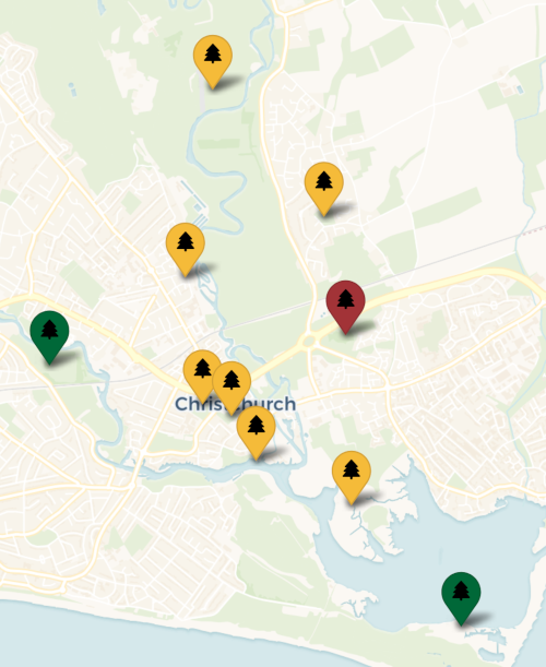
For a few months now, POTA parks have been added to the system in my area faster than I could get out and activate them. I wanted a way to even the score, so I started thinking about doing multiple parks in a day.
The middle of Christchurch has a number of parks temptingly close together. They’re also mainly small town parks with lots of footfall and only the kind of nature that humans curate. Not my ideal type of POTA destinations, which made them ideal for this—I could get in, activate, and move on without any fuss.
Three stood out—Druit Gardens, Christchurch Rec, and Knapp Mill Park, so I planned for a three-in-one roving activation, maybe the first two on foot and then driving to Knapp Mill.
But more markers kept cropping up on the map, all temptingly within 20 minutes’ walk of each other. From a quick drive and three parks, it expanded and expanded. By the time activation day rolled around, there were eight parks in the cluster that I hadn’t hit before.
It was going to be an eight-park rove.
On foot.
0840-0910: Druit Gardens
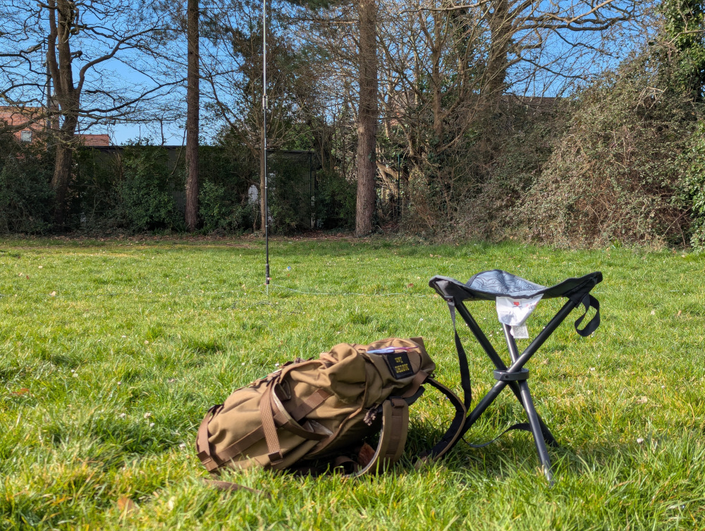
GB-2463 Druit Gardens was the first stop of the day. It’s a lovely small park, and towards the eastern side in the open area of grass I set up next to a park bench.
One passer-by asked if I was conducting an underground survey, which is an all-time new one for me among things non-radio people have asked if I’m doing.
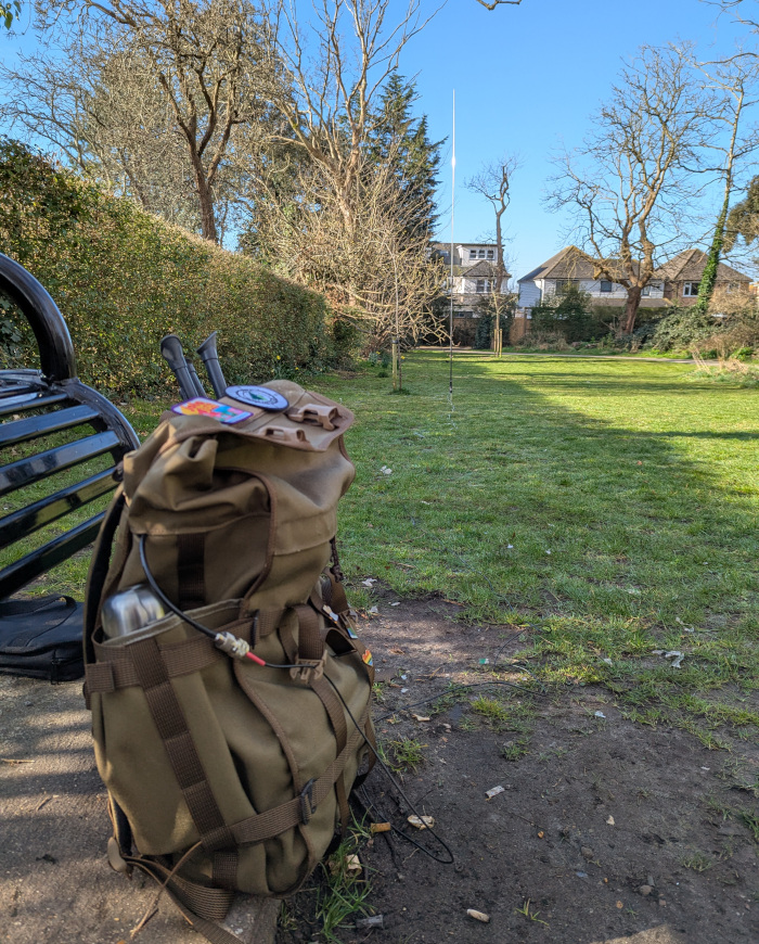
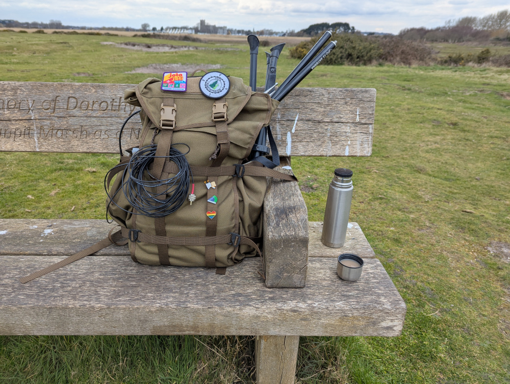
After 20 minutes of activation, surrounded by chirping blackbirds and singing robins, I had 23 in the log and it was time to move on. With the next park only five minutes’ walk away, I played with ways to pack up my gear for easy rigging at the next park. This was partly me practicing for RaDAR Rally which is on the horizon in the near future, and involves rapidly moving from one activation position to the next, so I wanted to experiment and see how I could speed things up. I left the coax attached to the radio and stashed it through a loop on the side of my bag:
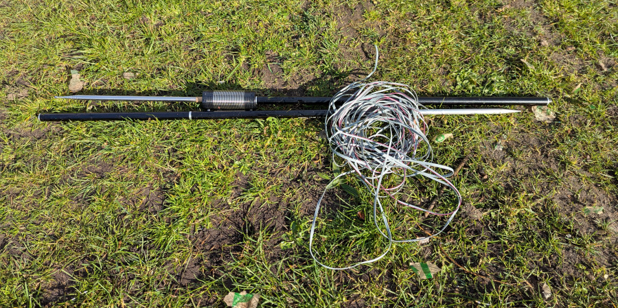
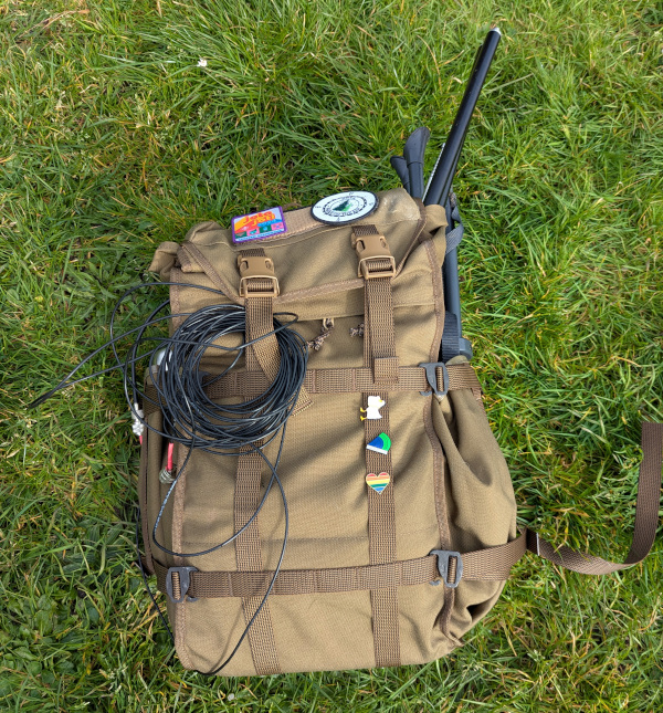
The antenna I split into two sections, and carried them by hand. I just had the JPC-12 vertical with me today, and stuck with 20m all day, to avoid wasting time setting up the dipole or reconfiguring for different bands.
0915-0930: Christchurch Rec
Next up, it was the turn of GB-2463 Christchurch Recreation Park. Again, a simple “get in, activate, and get out” job. In fact there was so little gap between this park and the previous one, that a hunter was still on my frequency looking for me!
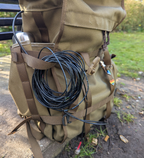
After this park, it was a 20 minute walk to the next, so I split the antenna down to four sections rather than two and stashed it in my bag rather than walking with it in my hand.
1000-1020: Knapp Mill Park
Third, it was the turn of GB-2462 Knapp Mill Open Space Park. With the waterworks, a big industrial site, nearby, there was quite a high level of noise here on the 20m band—it’s also not far from surrounding houses.
Hunters were starting to catch on at this point, and I had quite a few longer QSOs (by POTA standards) explaining what I was up to. After 25 QSOs in just over 15 minutes surrounded by squirrels’ antics, I was ready to head on again.
1035-1100: Avon Valley
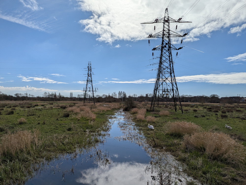
Just over the river, following a footpath through the waterworks, lay GB-0111 Avon Valley. Not far into the field, I set up again, enjoying the first bit of actual natural environment I’d had on this trip.
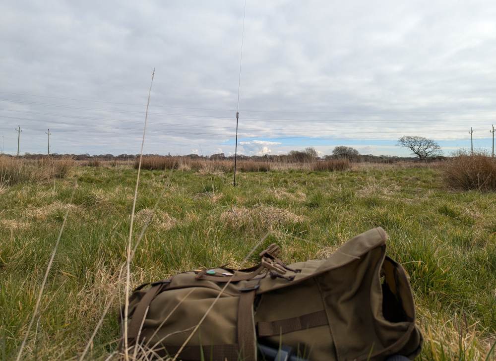
I hung around a bit longer here, got a bit of a pile-up going with the repeat hunters, and got 37 in the log before I decided to call it quits…
And hike eastwards across the valley to Burton.
Intermission: Avon Valley Marshes
I’d got less than a hundred metres before the ground got muddy, then soggy, then fully waterlogged. I began jumping from one clump of grass to the next, since they provided more solid ground, until one turned out to be not so solid after all. It was a layer of dirt and grass above a wallowing pool of water below, and my foot plunged in up to my shins.
Right. I was still 500 metres or more from the other side, and even more obviously damp areas lay ahead. This was a silly idea.
OpenStreetMap showed a potential route parallel to the railway line leading east across the valley, with gaps in the water courses and a “fordable” marker across another, and I set out for it hoping it might be a path raised above the swampy ground.
Of all my ideas today, this one was the worst.
There was no path alongside the railway line. Just a wide, open plain that slowly, lulling you into a false sense of security, turns from grass to swamp to salt marsh.
OpenStreetMap offered some promise at every turn, and aerial imagery showed a relatively dry area in summer, so I alternated between hope and despair as I tracked slowly across the field, dodging deep watercourses and nesting swans while letting the egrets and the deer figure things out for themselves. But by the time I was two-thirds of the way across, it was clear that I would be going no further. Each step took my feet deeper and deeper into the stinking mud and water, filling my boots again and again.
I turned south, jumping again between patches of reeds blanched white by salt. But that way soon closed off too, water getting deeper again with each step. I bore around back to the west, my heart sinking as I realised I was going to end up back where I started—the last hour of awful saltmarsh trudge was all in vain, and I would have to retrace my steps.
I seemed to have entered a fishing spot without realising, and only on finding a gate to leave the area did I see the back of a “restricted access” sign. (Insert Woody Guthrie reference here.) I guess they didn’t expect anyone to gain access to it the swampy way.
Shortly after leaving the fishing spot, the river turned me north again, and I arrived back at the railway line. I thought the slightly more solid ground presented a good opportunity to wring out my socks—it wouldn’t make a lot of difference, but it was worth a go.
Then the bells tolled for noon, and I started to consider my choices.
I had already had an adventure, somewhat against my will—my civilised town park activations had turned into a soul-sapping and wet slog. I could call it quits and go home, of course. But with only four parks in the log, it wasn’t quite enough for a POTA 5-park rover award. I could do one more park just to qualify, and save the rest for another day. Either way I would end up with yellow and red markers still on the map, and a job still to do.
But I hadn’t had an adventure. I had had half an adventure. Four more parks awaited, five hours of daylight remained, and I was not going to stop there.
It was another 10 minutes’ walk back north to the waterworks, where I could finally cross back to the other side of the river, then 20 more south again to the town centre where I could grab a supermarket meal-deal lunch. After that came a 30-minute trek up the side of busy main roads, all the way to Burton—the long way around.
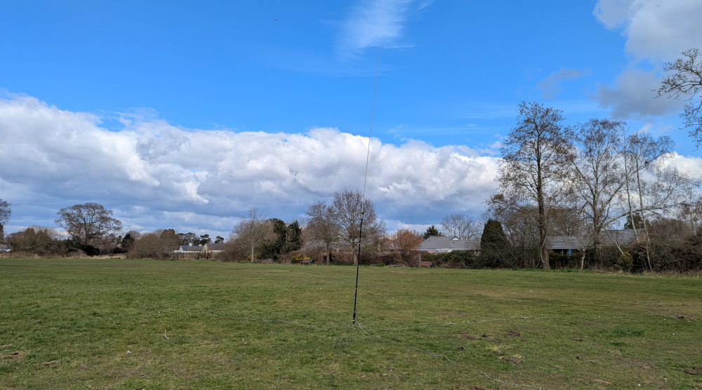
1305-1325: Martins Hill Rec
GB-3887 Martin’s Hill Recreation Park was park number five. Another plain empty patch of grass, I only spent 20 minutes here, getting 13 in the log. Things were starting to slow down a bit now, though some of the day’s regular hunters were in attendance again.
With Burton’s sole POTA reference activated, I retraced my steps back south to the main road.
1345-1355: Purewell Meadows
Next up on the list was GB-4055 Purewell Meadows. A very new park in the system, I wasn’t quite sure what to expect, but what I found was… basically nothing. Of the area shown on M1SDH’s POTA map, 95% was fenced off for livestock or horse grazing, with no obvious points of public access.
In fact, the only open space that wasn’t enclosed seemed to be an area of cleared scrub right by the road side, in the far south-east of the area. Not really what folks look for in a POTA spot.
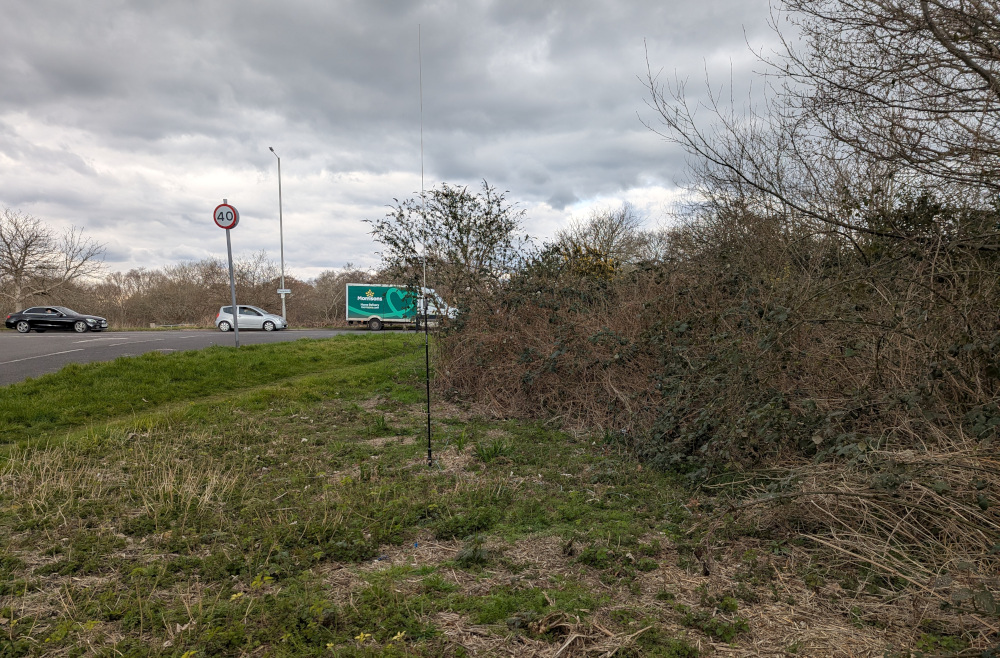
13 QSOs in the log in 10 minutes was enough for me. I packed up and shipped out as the overcast sky brought the first sprinkles of rain, heading south again towards Stanpit Marsh.
1420-1510: Stanpit Marsh
Oh goody. Another marsh.
Luckily, GB-1288 Stanpit Marsh is a bit more pleasant for a walk. One main path circles the area, made of gravel and generally above water level. There’s also a large area of non-marsh ground a couple of metres above sea level, where from a bench I could watch sandpipers in the mud and bunnies chasing each other around the grass.
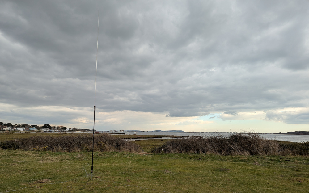
Things were really slowing down now, and half an hour on the radio only netted me 15 QSOs. Still, as places to sit and watch a whole lot of nothing go by, it was hard to beat. After a while I packed up and completed the circuit, heading west through Riversmeet Park back towards town.
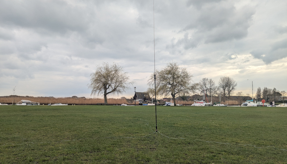
1550-1615: Christchurch Quay
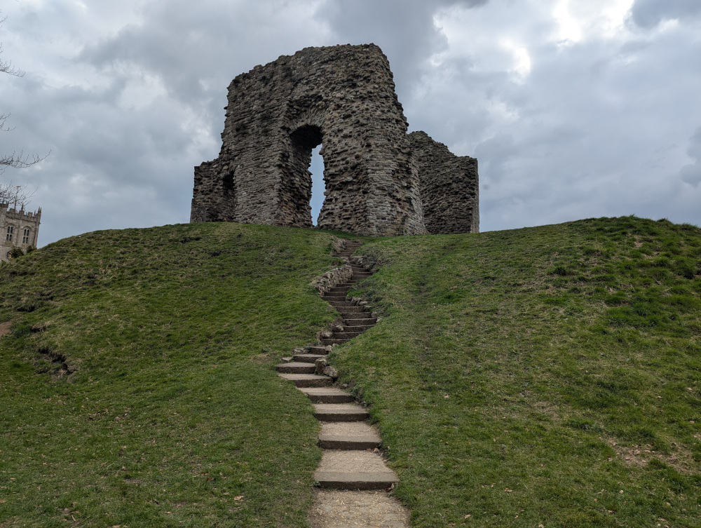
The home straight was here at last. The path up to Two Riversmeet leisure centre dumped me back in the centre of town, from where it was a short—and very familiar—walk down to GB-2461 Christchurch Quay. From Castle Street, the path starts past the old ruins—I climbed these steps up to the top every time, as a child.
And I climbed them again today, for old time’s sake.
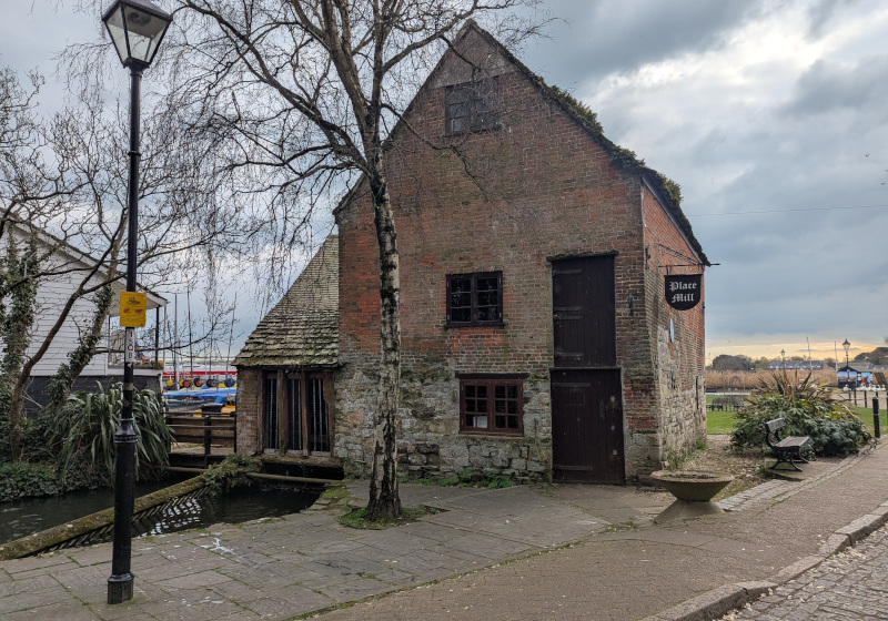
Then down through the formal gardens, past the priory, to the old mill that was once a tiny museum. The picnic table that I loved, made from an old weathered millstone, is still there today.
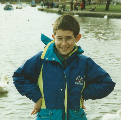
Then on, of course, to the quay. The quay where you can hire boats in the summer, where the swans hound you for any food you might have, where the tide comes to reclaim the land during the winter, where I played, where my son played.
Here’s me at Christchurch Quay, 30 years ago. Digging the glasses.
I was back in the middle of town. School was out, and the place was busy with playing kids and dog walkers, so I set up my kit and kept it as brief as I could. After a slow start, the activation did start to pick up, and I put 19 QSOs in the log before I decided enough was enough. It was time to pack up and head back to the car.
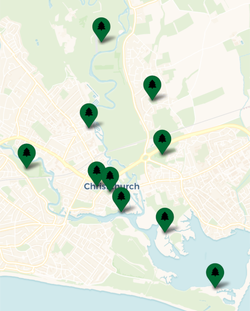
At long last, I was done. Eight parks in eight hours. 10.2 miles walked, one through a wet and stinking salt marsh and the next seven with wet socks. 23500 steps, 162 QSOs. A well-earned shower followed by a well-earned dinner, then a log upload that turned all my markers a cathartic green.
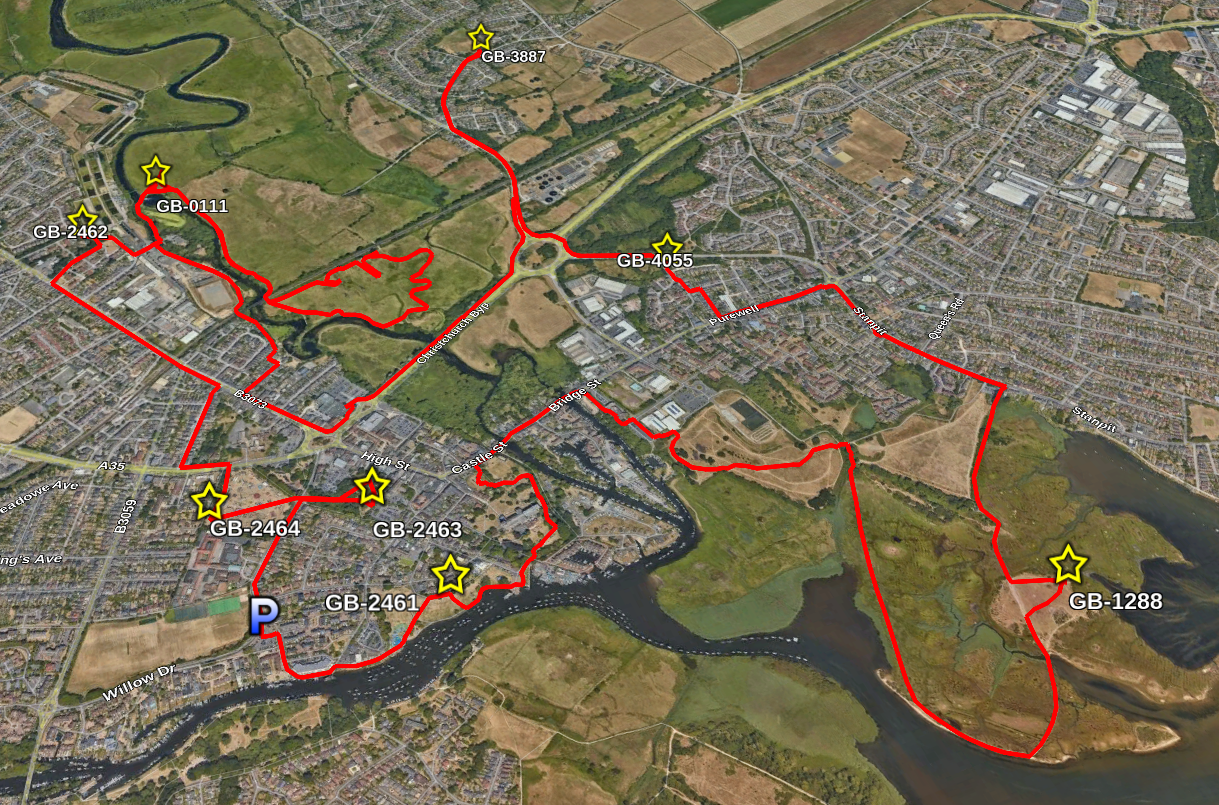
Here’s the long, wet, muddy and ridiculous route in all its detail:
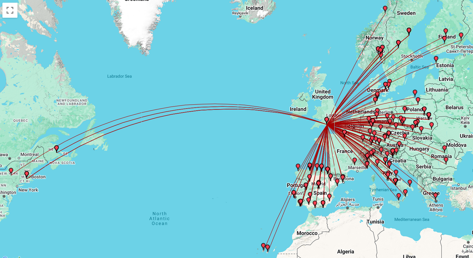
And the map of all the QSOs today, including the many duplicates from all my repeat hunters:
To all of my contacts, thank you so much for supporting this ridiculous endeavour! See you on the air next time, when I will do something much more sensible than this.
Comments