Last weekend I finally achieved something I’d have thought impossible six months ago: A POTA activation (of GB-4120 Forest of Bere West Walk and GB-4061 Meon Valley Trail) that was so uneventful, it became the first one I didn’t bother to write about.
However I’m pleased to say that only four days later, I am firmly back on my bullshit again with a 10-park rove across four different sites, a bunker, a castle, a lighthouse, a POTA 7-fer, and two solid hours of pile-up. Read on…
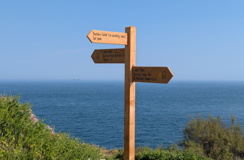 Signpost at Anvil Point
One Week Ago: The Plan
I got my first POTA “Rover Warthog” award two months ago, on a memorable and very damp all-day adventure around Christchurch, but I got my second last week after work, on a whim. Clearly it was time to set my sights higher, and next up is the “Rhino” award for a 10-park rove.
Thanks to a couple of newly-added parks, the lengthening days and the seasonal drying out of the Avon river valley, Christchurch should now be viable for a 10-park rove on foot. And while that is still on the cards for later in the summer, I also started thinking about “n-fers” and how many of my 10 parks could be achieved without actually moving. Thanks to a ridiculous project from last year, I’m always on the lookout for stuff like this, and nearby Durlston Head was starting to stand out as a potential POTA 7-fer, along with WWFF plus its castle and lighthouse.
Two nearby parks also remained unactivated: Days Park and Townsend Nature Reserve, so swinging by those would bring the count to nine. And while I had narrowly missed out on being the first activator of nearby Kilwood Coppice at East Creech, that site had a bunker reference, and Dorset was still on the to-do list for the UKBOTA Historic Counties event.
The plan was set. I’d start the day at Kilwood Coppice, swing through Swanage around lunchtime, and finish the day down on the coast for that huge activation.
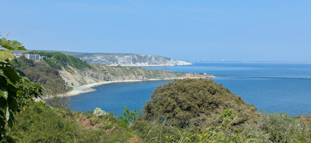 Peverill Point and Old Harry Rocks
0830-1000Z: Kilwood Coppice & Church Knowle AOB
The day began at 0830Z, 0930 local time, at Kilwood Coppice. I pulled up in the lay-by near East Creech camp site, finally finding a nature reserve with even less parking than Higher Hyde Heath—there is space for just one car here without blocking the road or the farm gates.
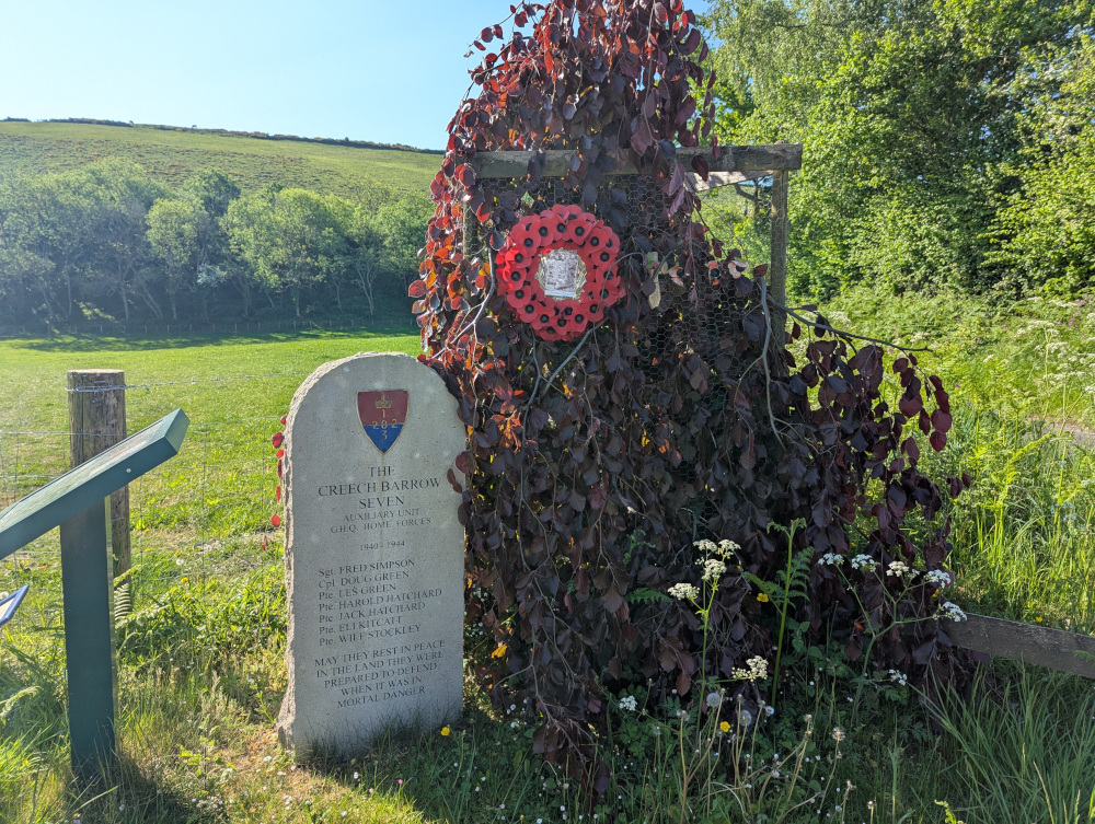 Memorial for the Creech Barrow Seven, soldiers of the Auxiliary Unit stationed here who lost their lives in World War II
I was expecting the bands to be hard going today, particularly early morning, so I wasn’t in a rush to get on the air. I followed the path down beside the field and through the woods, before it opened out on a grassy area that I would later head back to for the activation itself. I carried on through the rest of the woods, seeing if I could find the bunker itself, but unfortunately I couldn’t locate it. This page kindly shared by Jason 2E0JIV has some photos, but an incorrect location, and there was nothing at the location shown in the UKBOTA dataset either. The sign-board on site shows a third, and presumably more accurate, location, but unfortunately this was in an area now fenced off as part of a camp site.
 Location of the bunker as shown on the local sign-board
Whichever side of the fence it was on, I couldn’t locate it on this trip, so I headed back to the open field within the nature reserve to get on the air. My first activation of the day would be GB-4873 Kilwood Coppice Nature Reserve and B/G-1462 Church Knowle Auxiliary Unit Operations Base; the area also qualifies as part of the Dorset National Landscape, GB-0008 and GFF-0251.
I set up with the inverted-V dipole, plus the usual Yaesu FT-891 pumping 100W into it to try to overcome any QSB I might encounter.
It turns out I needn’t have been worried about the band conditions. I started on 40m as a lot of the bunker interest would be from within the UK, and although the band wasn’t in great shape with some significant fading, I rattled through 63 QSOs in 56 minutes making it one of the biggest pile-ups I’d had to date! I have recently joined the UKBOTA WhatsApp group, and it was good to see a number of names and callsigns I recognised from there calling in. They were joined of course by many regular POTA hunters, and another QSO with fedi mutual F4LUB as well.
I had said I’d work the 20 metre band as well from each location, but with it already being nearly 1100 local time, I thought better of it—I still had three more locations to go and I was expecting that the last one would take a lot of my time. So I packed down and shipped out, driving into Swanage for the next park.
1030-1100Z: Days Park
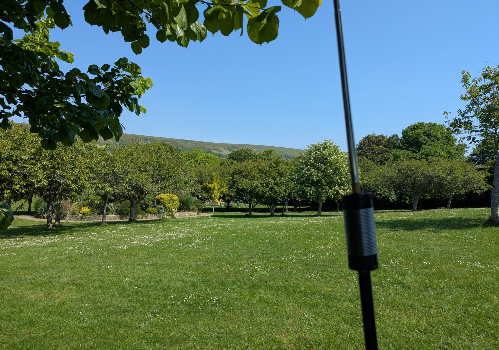
Next stop was GB-4192 Days Park, a small park which, despite being well within Swanage town itself, still falls within the boundaries of Dorset National Landscape, GB-0008 and GFF-0251 as well.
Days Park is lovely in the spring, with a small ornamental garden and rows of blossoming trees casting a welcome shade around the upper area of the park, while the lower end has a play area and plenty of space for dog walking and football. However, as I’ve mentioned many times before, these small town parks aren’t my favourite POTA locations as I prefer being out in “real” nature rather than heavily curated nature. So, I kept it quick here.
 Antenna set up in Days Park
I switched to the JPC-12 antenna here to save space, and worked on the 20m band only since the JPC-12 is not a good perfomer on 40. Working on 20 allowed me to make contact with a few people who would be out of range on 40m NVIS, including fedi mutual Tobias DC1TC, plus my only transatlantic contact of the day, Peter K2UPD, and a Canadian in Portugal, Manny CT7/VA3QF.
After 16 QSOs I was done—I had bigger and better things ahead. But the activation did prove one useful thing, which is that the replacement ground radials I made work fine. (I broke the ribbon cable radials on the JPC-12’s previous outing, snapping them off from the ring terminal, so I made a hopefully more rugged replacement in the form of three 5m lengths of 18AWG wire.)
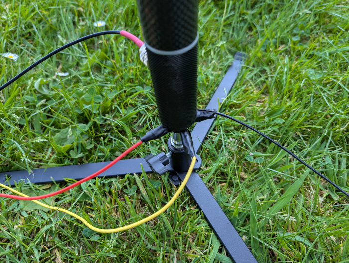 The new JPC-12 ground radials
1200-1245Z: Townsend Nature Reserve
Going back to “real” nature, on the way to Durlson Head was GB-4191 Townsend Nature Reserve, again part of Dorset National Landscape, GB-0008 and GFF-0251.
I initially tried to make it onto the nature reserve via the path at the top of Manwel Road, but this is now completely overgrown and impassable after 10-20 metres. So, I took the shortcut across from Manwel Road into the holiday park to the west, and took the proper path from there south into the reserve.
This is proper “Hobbit country”, with winding paths through clumps of trees and walls of grass-covered earth; dry-stone wall and countless tiny mounds; you could well imagine a place like this being an inspiration for tales of a small and reclusive people.
 Townsend Nature Reserve
There was enough space here that I switched back to the inverted-V dipole and again headed for the 40m band. There was a surprising amount of noise here considering I was at least 150m away from the nearest holiday home, but a baseline noise level of S5 and regular peaks of S9 made this activation a frustrating one.
After struggling for 20 minutes, I thought I would switch out for the 20m band and see if I had lower noise levels there, but unfortunately at that point… some friends arrived.
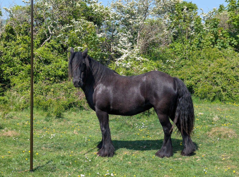
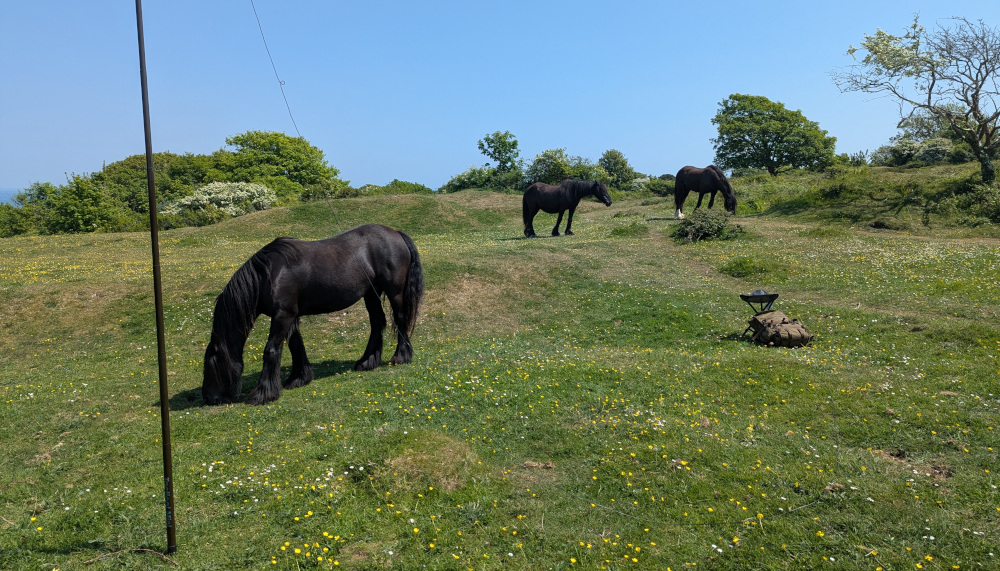 The horses approach
One of these horses was particularly bold, and came up to give me and all my equipment a thorough investigation. The other two were more flighty, regularly kicking their hooves and darting about, which made me concerned enough that I decided to stop the activation there. “Don’t fuck about with wild horses” is a good rule for any outdoor radio fan!
 Another HOTA activation in the log
I tried to work around the horses to pack my station down, but unfortunately they were very persistently hanging around. I didn’t want to scare them off, of course—a risky course of action, and besides, they had more right to be there than I did. So I carefully worked around to the antenna, slowly lowering it while Bold Horse took a liking to my backpack and particularly to my Thermos. Apparently, the British love of tea even extends to the wildlife.
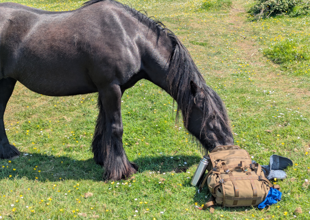 The investigation of my stuff continues
I got a big toothy grin from Bold Horse once it had finished sniffing and licking my stuff; I’m not sure whether that’s a good or a bad sign when it comes from a horse. Nevertheless, I let it continue doing its thing, and patiently waited to get my horsey Thermos back to complete my pack down.
I had 12 QSOs in the log, good enough for an activation, and it had passed 1400 local time, so it was definitely time to move on to my last location of the day.
1315-1600Z: Durlston Head
Time for the big one.
Durlston National Nature Reserve is its own reference in both POTA (GB-0187) and WWFF (GFF-0376), as well as being part of the Dorset National Landscape, GB-0008. But not only that, it’s also part of GB-0183 Dorset and Devon East Coast World Heritage Site, GB-0133 Isle of Portland to Studland Cliffs Conservation Area, and GB-3767 South Dorset Coast SSSI; the coast path running through it is GB-1265 South West Coast Path, part of GB-0711 King Charles III England Coast National Scenic Trail; plus it has the overlapping 1km activation zones of WCA G-02159 Durlston Castle and ARLHS ENG-001 Anvil Point Lighthouse.
Phew.
Now technically, I could have pulled up at Durlston Castle car park, sat at a picnic table in the adjacent field, and activated all of that lot. Given the hassle I’m about to describe, I probably should have. But I didn’t think it fair to claim a lighthouse activation without actually going to the lighthouse, and besides, these boots are made for walking…
 Durlston Castle
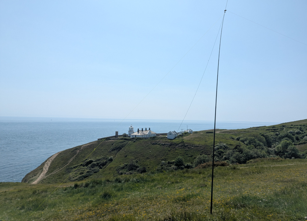
The coast path from Durlston Castle drops steeply down to the headland clifftop, and sweeps around the south side of the castle to the Great Globe and along to the west. This section of the popular trail is well maintained and signposted, including look-out points for birds and dolphins, and snippets of poetry carved into the rocks on the cliff edge. After around 500 metres, you pass Tilly Caves, and Anvil Point Lighthouse hoves into view.
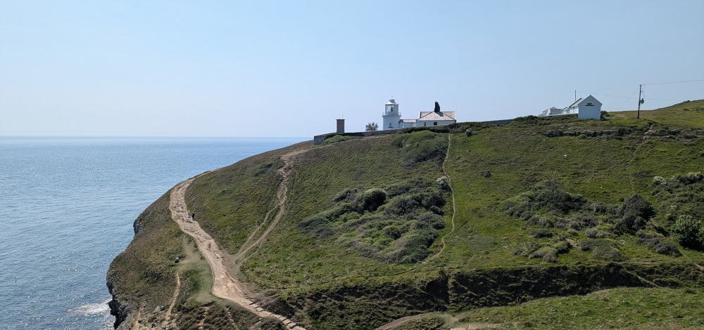 Anvil Point Lighthouse in the distance
Also dominating the landscape here are the Nautical Mile markers. Where’s a 160m dipole when you need one?!
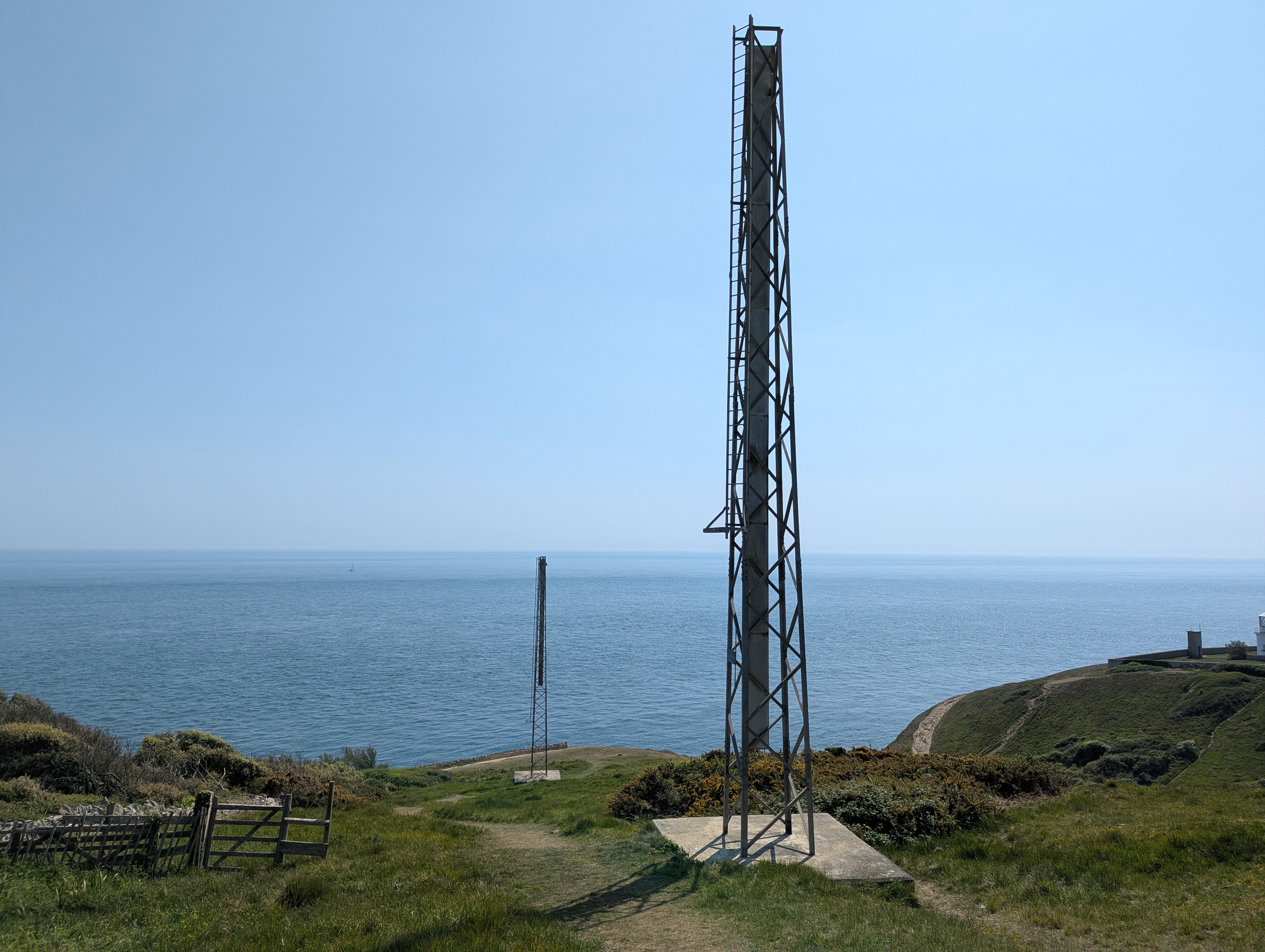 Eastern Nautical Mile markers at Anvil Point
From here, a steep drop down to sea level separates this section of the coast from the one on which the lighthouse sits, but in the interests of time and wanting to get on the air, I decided to set up on this side. I headed up the hill and picked a spot which would keep my station within 30 metres of the coast path; the path really splits in two at this point, providing a gentler route for those less able as well as the very steep route along the clifftop, so I could have picked almost anywhere.
I set up my antenna, started calling CQ, and reached for my phone to self-spot and kick off what I was sure would be a popular activation.
Ah.
No signal.
 Durlston Head activation spot (attempt #1)
Self-spotting is of course a purely optional part of POTA, and a purist would probably say you shouldn’t even do it. But I had to get this activation going somehow, and that meant getting spotted. I had two QSOs here, but neither of them were with POTA users, and after 10 minutes I still didn’t have a third. Time was ticking on, I couldn’t get a spot out, and against all odds it was looking like my ridiculous 7-fer activation could end in failure.
Failure, as always, is not an option.
I made the decision to pack down my kit and continue hiking. I couldn’t find phone signal anywhere on this side of the ravine, so it was going to be down, and back up again towards the lighthouse itself. The eastern side is honestly more of a scramble than a walk, with steep sandy sections requiring hands as well as feet. And the climb up the western side isn’t much better, where raw protruding rock and slippery gravel conspire to fuck up your ankles with any unwary step.
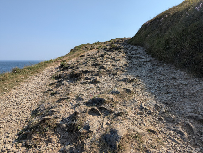 The Great Dorset Ankle-Fucker. The smoother looking gravel section on the edge is a trap, and is immediately next to a 40-metre drop straight into the sea.
The lighthouse is still active, although nowadays its function is automated and the associated buildings are rented out as holiday cottages. While it doesn’t offer public access, what it does offer is a spot around 20 metres west of it, atop a small rise in the ground, where there is a brief glimmer of 2G EDGE data from some distant Vodafone tower.
The game was afoot.
After setting up my antenna again, making a few CQ calls, and holding my phone high above my head, I hit PoLo’s self-spot button. After a few long seconds, it went through.
The contacts started coming. Slowly at first, with a few minutes between each, then faster and faster and faster. I had my regular POTA hunters, some very excited about a 7-fer spot. I had my fedi mutuals, and returning callers from my morning bunker activation. I spoke to lighthouse activators about their escapades and our plans for the summer. I spoke to someone who grew up in Swanage and remembered it well, and to several QRP stations coming in strong when the peaks and troughs of QSB allowed it.
By the time the pile-up started to fade away, 90 minutes had passed, and I had 62 more contacts in the log. I was exhausted!
Constantly in the back of my mind was my confident statement from the day before that I’d activate on 20 metres as well—that 90-minute pile-up had just been on 40! But it was 1700 local time already, and if the activation was that popular on 40, who knows how long the pile-up would continue for on 20. The unfortunate truth was that I just didn’t have the time. I would have to go back and repeat it on 20 another day.
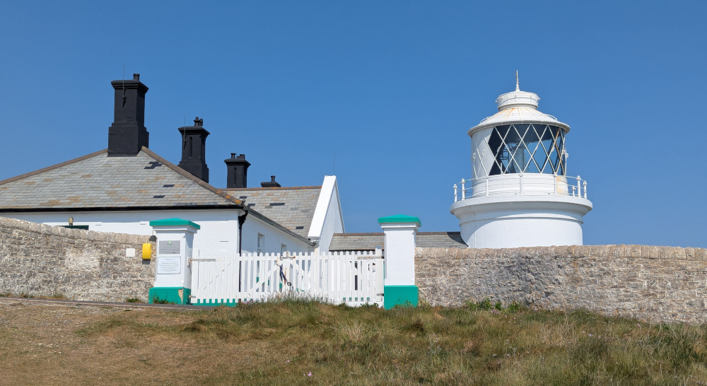 Anvil Point Lighthouse
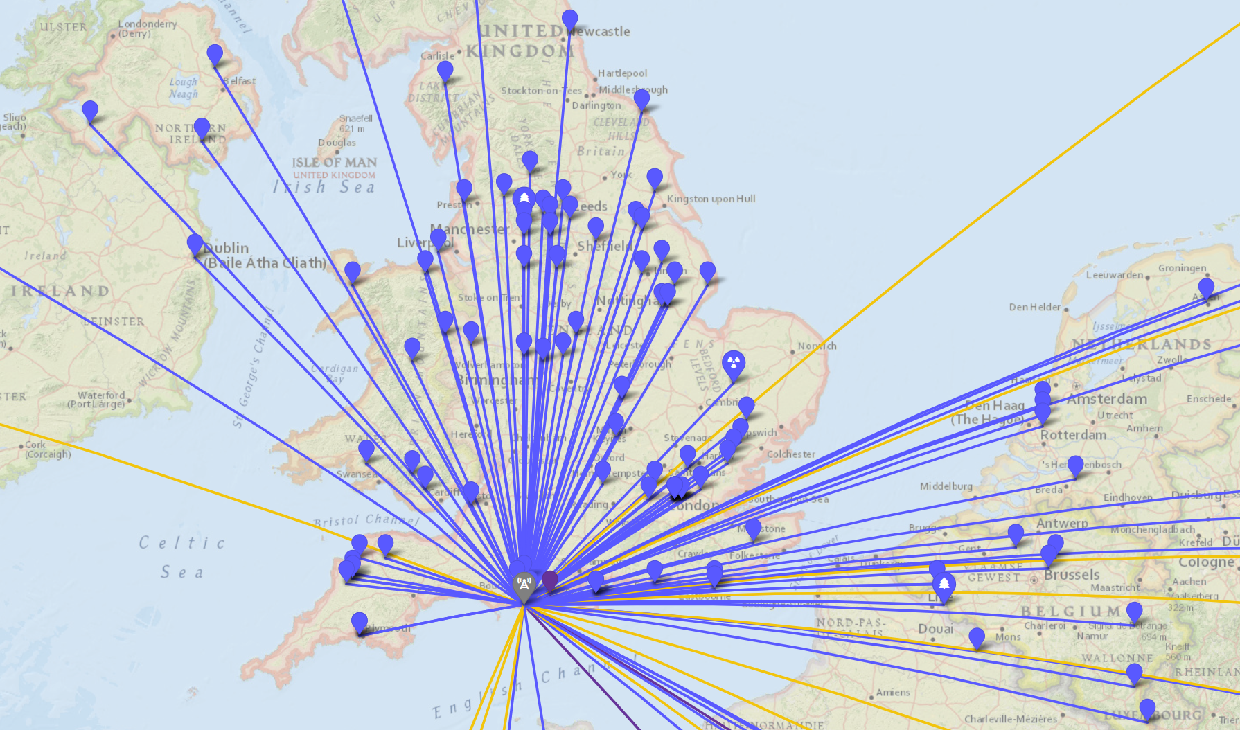
It was a short but difficult hike back down the ravine and up the other side, back to the car, then the winding country lanes to the ferry at Shell Bay, and onwards towards home. 10 POTA references activated, along with two WWFFs, a bunker, a castle and a lighthouse; 157 total QSOs in the log, four miles walked, and nine hours well spent.
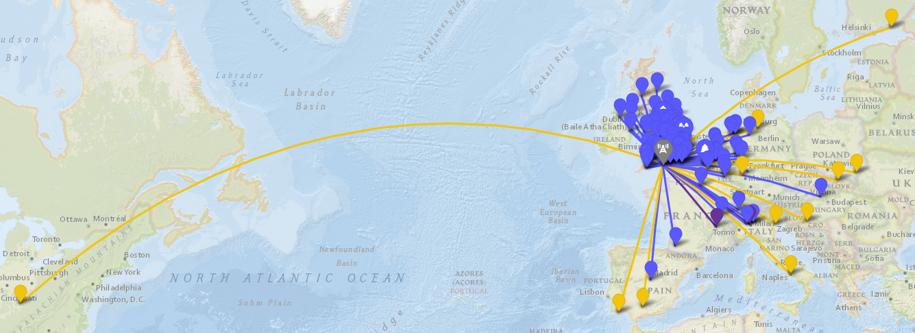 Map of all POTA rove contacts
 Map of POTA rove contacts (zoomed in)
Many thanks to everyone helping me complete my latest POTA rove. See you on the air next time!
Comments