The new-look UK Bunkers on the Air website went live today, so I can finally announce a project of mine from earlier in the summer: providing the mapping support for “BunkerBase 2”.
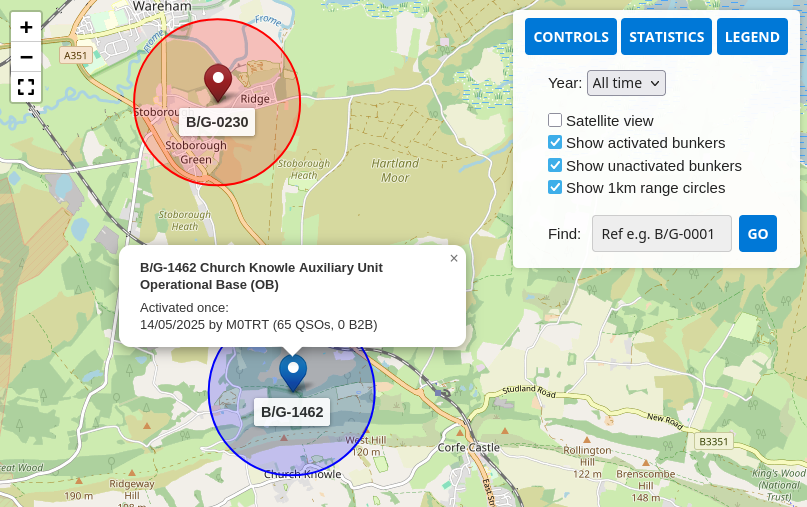
While Carl M0ICR and Steve M1SDH did the vast majority of the work for the new site, I was asked to provide some maps for the general “Bunker dashboard”, which is public and shows the overall state of the UK Bunker map, and for the user-only Activator and Hunter dashboards.
I did find the working environment a bit challenging, as the site is entirely based around WordPress and my “IDE” would be a text box embedded in a web page, in which all the map code would have to live—PHP, JS, HTML and CSS all in one file. It also didn’t offer much in the way of version control, so I spent a lot of my time copy-pasting the code into a local file I kept within Git, so at least I could track my own changes and revert my cock-ups!
However, it’s now live and working fine, so it seems I got there despite the challenge of the toolset. The map codebase is the same for all three implementations, just with a different flag provided at the point the code is included in the main page via a WordPress shortcode. Each one allows toggling activated(/hunted) and unactivated(/un-hunted) bunkers, toggling 1km activation radii, filtering activations/hunts by year, and searching by bunker reference. Statistics and a legend are also displayed. Finally, each marker is interactive, with a click bringing up a pop-up showing more detail on the activation history of the bunker.
Hopefully the site’s users find it helpful for planning their future activations. It should also be a good basis for any future mapping efforts on the UKBOTA site, such as those for special events.
Comments